Escorted Tours

Failte gu Fuadach nan Gaidhealt na h-Alba

Failte gu Fuadach nan Gaidhealt na h-Alba.
The Highland Clearances were a devestating part of the history of Scotland. For many it changed not only their way of life but also shaped the rural future of Scotland. Many villagers suffered at the hands of their landlords and tackmen and fought a desperate struggle to find a new life. Others managed to propser in a new life that never saw them return to Scotland again. Here is a resource that supports the documentation and historical value of this important area of Scottish history. You can follow in the footsteps of these villagers and find detailed descriptions and locations of the remains of some of the villages and townships through site descriptions, photographs and suggestions for further reading and links to follow.


Showing posts with label Perthshire. Show all posts

Monday, 27 February 2012

Glen Tarken and her townships 3. Morell Township.

This township is the last that we visit on this trip to this particular Glen at this time and one could consider this to be the main attraction of the day.

Morell Township. C: Author
Walking down to the site from Jerusalem, the site looms into view.  As you approach the site you will walk through a walled fence area that also has the remains on both sides of the wall, both higher and lower to your position on the path. Again, take time to view these sites. As you get closer to the main site, there is a large deer fence that seperates the village from your current position, but a gated styal affords you access to the site.  The deer fence is there for a reason as there are plenty of forestry work and logging taking place at present.

Whilst I was there, I was rewarded with a visit from several deer who made their way through the village. I am never sure as to whether the fence is there to keep them in or out! Upon entering the site, I implore you to stop and take in the views all around you which, on the day that I visited, were breathtaking.


Morell Township: C: Author

Morell Township. C: Author

This is a large township that can be traced easily over the area. The buildings, their divisions and layout can easily be identified and distinguished. There are outlines of a large walled sheepfold at the rear right of the site and the remains of a well area to the northeast of the site. Alot of the buidling are almost gone now but it is worth taking time to absorb the site and consider the conditions such an elevated and sloped site must have had on the community living here. The hardships faced to just survive each day.

At the end of your time at the site, you have two options for return. Retracing your steps back along the path to Wester Glen Tarken and the A85 is probably the best. You can walk straight down the hill in front of you, it is steep,but there is a path/track that you will pick up. Here you can also rejoin the disused railway route and turning left picking up the logging road back to the A85. Although this is the shortest route, I would not advise it as the logging work being carried out can be a dangerous area to enter.

Wednesday, 15 February 2012

Glen Tarken and her townships 2. Jerusalem.

Jerusalem Cottage. Copyright Author
Returning to our posts on the Glentarken area. We leave behind the township of Wester Glentarken and following the path up and around the back of the village. We climb up and follow the path round until we come to a bridge on our right that stretches across the burn. It is worth stopping here for a moment to enjoy the falls below and also note the remains of further buildings, behind us to the left, that make up the wider Glentarken community.


Copyright: Crown

Carrying on, across the bridge follow the path up until you arrive at the remains of a building situated next to the renovated croft house. Here you have arrived at Jerusalem.

There is some confusion as to the naming and placing of the townships of Glentarken, Morell and Jerusalem. This area is annotated as 'Easter Glentarken' as depicted on the 1st edition of the OS 6-inch map (Perthshire 1867, sheet xciii). We can identify the area on the map as comprising of three roofed, two partially roofed buildings and two enclosures. Later OS maps show this area as Jerusalem and the Easter Glentarken as slightly higher up the Glen. (As shown here). A later posting will add more information about
Easter Glentarken.

Jerusalem cottage. Copyright: Author
Very little is known as to why this particular township area is known as Jerusalem but there is a lot of information relating to two saint fillans, and the close relationship to the area of St. Fillan at Loch Earn. One of Irish and one of Scottish Origin .The St. Fillan whose feast is kept on 20 June had churches dedicated to his honour at Ballyheyland, County Laois, Ireland and here at Loch Earn, Perthshire. References to the feast of St. Fillan being on 19 January occasionally appear and agreement upon which is correct has not been reached.


Remains close to Jerusalem. C: Author
There is evidence to show that the Saint, and his followers, held a house in the area. Further information regaring this heritage can be read here from an article written in 1895. (Courtesy Archaeological Data Service, University of York).

What ever the story, and what ever the reason, I find this a really interesting area and one of such beauty. Throughout my visit , I was occasionally joined by deer running across the area, and of course amazing views. Don't rush your visit to this area, but immerse yourself in the history and emotion of the villages.

Monday, 6 February 2012

Glen Tarken and her townships 1 . Wester Glentarken, Loch Earn.

Loch Earn from Easter Glentarken. C: Author
As I sit here writing this post watching the snow fall heavily onto the paths and garden outside, it is hard to think that this photo, and my visit to this area was only last Friday, when I was blessed with a crisp white morning that gave way to brilliant sunshine and a degree of early year warmth that made the visit to the townships of Glen Tarken a joy.

This is my first visit to the area to record the townships and  and as I now study the OS maps and research further the information on the area, I think you will find this area as interesting as I.


The shores of Loch Earn, and this particular region, provides an area comprising of more than one settlement in close proximity to each other. There are the remains of the settlements that are known as Easter and Wester Glentarken, the township of Morell and an interesting site known as Jerusalem, which I hope to add verse to in a later posting.

Wester Glentarken. Copyright: NLS/Crown
We approach Wester Glentarken from the roadside on the A85. We move swiftly through a farm path and very quickly the township comes into view, being a mere 10 minutes walk from our starting point. 

The village or clachan, as the orginal collection of dewllings were known as, contains the remains of thirteen rectangular buildings, four kilns (one probably a lime-kiln) and associated enclosures. The buildings vary in size from 31.0m x 5.5m to 7.0m x 4.5m with walls up to 2.0m in height.


There is a barn in the middle of the clachan that has been roofed and used for many different uses to support rural life in the community.  Enquiries carried out by previous  reserchers have revealed that the larger group of buildings included a school for  upto sixty children and that the area was finally depopulated about the turn of the last century.

There are further remains to the left of the pathway slightly further along the path that would have formed the same township area.

Wester Glentarken. C: Author

Wester Glentarken. C: Author

Wester Glentarken. C: Author

Wester Glentarken. C: Author


The next posting in this series will take us up past Wester and towards the village of Easter Glentarken.

Friday, 3 February 2012

Glen Quaich and her Townships ~Croftinafighag.

Copyright: NLS / Crown
 Continuing our walk along the path from Easter Turrerich, we come to a small croft township site that consists of five unroofed buildings, two enclosures and a sheepfold. This site is very close to the now installed power lines. There are the remains of 5 buildings in all and evidence of sheep enclosures to the east of the site into the next field area. The croft is located next to a mature woodland.

This is an interesting site in that it is lower that the others on the route and there is still evidence of the different divisions in the buildings. There is also signs of some good construction techniques.


Croftinafighag. Copyright: Author
 This is a nice area to stop, have a coffee and a spot of lunch before continuing the 2miles to the next location. Whilst having your lunch and contemplating the beauty of the area and the Glen in front of you, you may turn your thoughts to the reasons for the clearances and why people would have had to leave.


Most of the people who lived in these areas of Perthshire worked on the land or were dependant on those who did. They were hard working, they had to be, considering the sometimes rocky, infertile hill ground which they had to cultivate in order to maintain their families. They were God fearing, attended church regularly and probably paid lip service to the laws of the church, but they would have no choice as the Church was their only help in times of need. This bears evidence throughout the period of the clearances in almost all areas of Scotland, with the church and the clergy often working for the villagers but often working with the Land owners. The physical presence of the church often provided a refuse in a lot of cases to families and whole communities after being evicted from their homes. The most famous of these is the clearances of Glencalvie in 1850 and Croick Kirk.(A brilliant account of the relationship between the church and the transformation of the highlands throughout this period can be read in the book, The clergy and the Clearances, obtained here


Easter Turrerich. copyrigh Author
Here it may be worth considering that some left the area not forcebly, as often reported when writing about the period of the clearances, but may have left through choice.

It would be naive to suggest that forced clearances never took place in Highland Perthshire; the Duke of Atholl was the first to clear some of his land to make way for sheep. The clearances at Glen Tilt, in Blair Atholl, were the first recorded evidence of the clearances in Scotland. The lands here, in Glenquaich, were cleared along with some parts of the Parich of Dull by the Earl of Breadalbane around 1830.


Many of these people left their homeland by choice, they were not forced out. Especially after the landowners had amalgamated the small farms or crofts, such as the one you sit in now, there just wasn’t enough to keep young people at home.

Emigration became an option for many with agents advertising for young Scots to go to the colonies where they were needed and work was plentiful. (The last post I published provided evidence of the type of advertising and testimonials used by the Canada Company)

Another reason for a areas becoming desolate was the common custom in Highland Perthshire of sending young boys south to learn the art of animal husbandry and farming, returning later, if at all, to take over the croft or farm in the area. Soth may have been to the Lowlands or into England where farming on larger scale was being carried out. Some may have returned with the Yorkshire farmers who obtained tenancy on the newly created, and enlarged, sheep farms. Others may have found employment in the new mills of Yorkshire and Lancashire where accommodation and employment would have been more lucrative than returning to the harsh realities of Highland life.

(adapt. Liney, K. 2006. 'Researching in Highland Perthshire Part 1' North Perthshire Family History Group.Sept. 2006)


Tuesday, 31 January 2012

Glen Quaich and her Townships ~ Easter Turrerich, Perthshire

Copyright: Google Maps
This posting focuses our attention on the continuing walk along the banks of Loch Freuchie in the Glen Quaich areas of Perthshire and up towards the township of Easter Turrerich. 

The path towards the township from Wester Turrerich is a good path still used today by walkers and farmers alike and continues along the length of the Loch to our final destination at Amurlee.

Like the township and mill at Wester Turrerich, the site holds commanding views across the loch and into the valley beyond. The three pictures provided here show different evidence of the settlement from1863 right through to present day.


Copyright: Crown


Copyright: NLS/ Crown
The three pictures provide a fascinating view of the main part of the village and there is evidence of a another part of the village slightly past the main township, halfway down the slope of the hill on the right. 

Be sure to visit both.


The site, and others along this route are also accompanied by the overhead transmission lines of that run through the valley and close to many of the remains. Please be careful when walking near to these.


Easter Turrerich. Copyright: Author
From along this valley, many of the inhabitants left these townships and made the journey across to Canada and to a new life. Records show that in 1842 the Canada Company set out to obtain statements and evidence from those who had settled in the new colony to help sell parcels of land to others coming across to settle. Of interest to us, there are statements collected from settlers from a John Crerar, Robert Frazier and John Stewart. 


At this time, I am unable to establish exactly as to which township they were from, but they were from Glen Quaich and therefore we can confirm that their residence would have been in one of the townships we cover on this journey.

I have reprinted extracts from one of the statements below.

John Stewart's Statement

He came from Turrerich, in Glenquaich, in 1832, having left the glen that year about the middle of June, and arrived at North Easthope on the 1st of September; eight families from the same place emigrated and travelled together and settled in this township and in the adjoining one, South Easthope.


Easter Turrerich. Copyright: Author
This settlement was only then beginning, for in the distance of twelve miles and a half between Stratford, (called then the Little Thames,) and the easternmost part of the tract bordering on Wilmot, there were only three houses or "shanties," occupied by Mr. Helmore, Mr. Fryfogle, and Mr. Sargint; one other settler, Mr. D. Bell, had just arrived, but he had no house up. These settlers were on the road side, for it was in 1833 and 1834 when settlers moved to lots of land off the main road.


The farm which he leased in Glenquaich was a small one, a few acres, with a privilege of pasture on an adjoining hill. His neighbours were similarly placed; possessing only what may be called "small holdings" from five to fifteen acres each. His family then were six in number, but not of age to assist in chopping and clearing but very little. There are three of them now well able to help, and they perform the most of the work.


Easter Turrerich. Copyright: Author
He applied to the Canada Company for three lots of land, 100 acres each, situated on the road side, and the following year he also applied for the three lots in the rear, in all 600 acres of land. He commenced at once to chop and clear the land, and built a small house. There were so few settlers at that time that the houses though small took no little trouble to put up, but the same difficulty was not experienced next year, as the settlement increased rapidly. 


When he came he paid and got a deed for one of the lots, and paid part on the other two, an instalment; since that time he has paid money on the five lots.

When the spring came, or rather towards the commencement of summer, his money was exhausted, but the provisions bought were sufficient till the crops were ready. From the crops of oats and potatoes this season he made some money, and particularly as they were scarce, and a brisk demand by increased emigration and traffic by the main road. The land since that time has yielded sufficient, not only for support but for sale. His family have been industrious, and he has managed to be economical in every thing.
 
Easter Turrerich. Copyright: Author
He has now a good stock of cattle: they had the first winter one cow, which gave milk till spring, when he bought another, and at the same time a yoke of working oxen. He has now one span of horses, one colt two years old, and another one year old, two yoke of working oxen, one yoke of five-year old steers, two yoke of two-year olds, three steers, seven cows, six calves, forty-six sheep, five year old heifers. 


 He sold two cows the other day, and has during these some years past sold a good many cattle. He has about 102 acres of cleared land. He had this year forty acres in hay, twenty in pasture, seventeen acres in wheat, fourteen acres in crops of oats, barley, &c., and ten acres in fallow. He has nearly ten acres of new land cleared this season for wheat. 
 

Easter Turrerich. Copyright Author
He states that all his neighbours have succeeded well. Many have emigrated this season from Glenquaich, and expects that next year all his old friends in the glen will be in Canada, and in this tract. A brother-in-law, who has been settled for some years in the township of Beckwith, has taken up 900 acres of land in the adjoining township of South Easthope, to which he intends removing in the winter or spring.


(Courtesy: University of Waterloo, Canada, whose copyright is recognised)

The statement not only provides evidence of  mass emigration from the Glen and a hard former life but an insight into a new more prosperous life being developed for all.


Friday, 20 January 2012

Sallachill Township Area

Further to my earlier discussion regarding Sallachill, I am now able to post some of the photographs that I took on that visit. The site is extensive  and the footprint of the township is sprread over three distinctive areas. These I will call lower, middle and higher.

Lower village area
Typical footprint remains of aea
Gable and left wall remain


Another of the remaining buildings
Long barn with dividing wall

Complete gable and corner wall


Sunday, 14 August 2011

Salachill Township Area. Perthshire

Today, after two weeks of torrential rain, I was able to resume my activities and headed out to the township of Salachill to continue my recording of villages and townships in the Dunkeld / Perthshire area. This is proving to be a very rich area for townships and discoveries

Salachill is a site that I have wanted to visit for a while and I was not disappoined. The only disappointment was the new wind farm that they are building across the area, so careful positioning of photographs was required!

The township is situated at NN954 427 and can be accessed along good paths from Ballinloan Bridge. Be carefull though, the are is very boggy and after all the rain, be prepared to wear suitable boots and clothing to achieve your aim.

Crown Copyright.
Crown Copyright


Salachill is an interesting site to visit. The remains of this township are situated on a hillside above the NE bank of the Ballinloan Burn,around 1.5 miles from Ballinloan Bridge. There are around twenty-three buildings, many of them are grouped into farmsteads, linked by trackways and set within stone-walled fields scattered with field-clearance heaps. The 1st edition of the OS 6-inch map (Perthshire 1867, sheet lxi) depicts almost all of these buildings (20 unroofed buildings).

Within the main area of the township, within the lower village are the remains of four farmsteads with many of them set into the hillside, or terraced up on their downhill side. These each comprise of five or six buildings loosely clustered around an irregularly-shaped yard. Two of these are located on a terrace immediately above the Ballinloan Burn, while the other two are situated slightly higher on the hillside. two of the buildings don't fit neatly into this arrangement and they stand in isolation at the W edge of the site.

The overall construction of the buildings on the site are very similar being roughly rectangular with square corners and in most cases gable-ended. they have faced-rubble walls mostly with cruck slots visible in one or two of them.

The size of the buildings can be divided into two distinct groups. In the first group there are five buildings measuring internally between 20.3m and 29.5m in length and between 3.8m and 4.5m in breadth. There is one of these long buildings in each farmstead, always on the N side of the yard.  The fifth is one of the two isolated buildings at the W edge of the site. They are all divided into two or more compartments and most of the compartments have separate entrances, which in all cases are in the South side of the wall, opening onto the yard. In two of the buildings, fireplaces can still be clearly seen in the west gable.

The other eighteen buildings are clustered close to the larger buildings, and help to define, the limits of each steading's yard. Several of the larger examples are divided into two compartments, and there is evidence of an upper floor in at least two cases.  Occasionally features survive which suggest a particular function: a fireplace in one building signifyes use for domestic occupation, and the opposed entrances in four buildings (one in each farmstead) points to their use as barns.

Wednesday, 27 July 2011

Glen Quaich and Her Townships ~ Wester Turrerich

My visit today was to the Glenquaich area to start to document and record the villages in this area. This is quite an interesting area as there is quite alot of detailed evidence and testimonies from people removed from the area and their eventual new locations.

Location of Wester Turrerich


The visit today concentrated at the western end of Loch Freuchie and the township(s) around Wester Turrerich. There is an ordnance survey map of Scotland from 1843 to 1882,showing the location of this,and other townships, that I will be visiting over the coming months. This can be accessed here

A modern day location map, I have included on the left. The grid reference for the site is NN858 389


The clearances in Breadalbane, did not occur until the 1830’s, under the command of the Second Marquis of Breadalbane. In 1835, the factor, James Wyllie, had cleared the entire population of Glenquaich, with many (and most) taking flight by sea and populating lands in the new world, including the Huron settlement in Western Ontario and North Easthope, County of Perth, Ontario. There, they settled with other families from Amulree, Auchnafauld, Aberfeldy and Kenmore. All areas covered by the events of the 1830 clearances.

Further information regarding ships passage to Canada can be accessed here The information on these pages has been extracted from various government records, as well as the odd shipping record (mostly from the Allan Line). It contains, voyage accounts, emigration information, lists of ships sailing to Canada, information on the ports, and on the people.

After a decade, the land was striking in its desertion. Of the 3500 inhabitants once living along the Loch Tay and within the Glenquaich valley, only one hundred were left by 1850. That year the Second Marquis tried to raise a Fencible Regiment, as had his father so successfully in the eighteenth century. He found no recruits. An old man of Loch Tayside growled at him to “Put your red coats on the backs of the sheep that have replaced the men!”

Here are some photographs recording my visit today. (copyright Author)

Approaching from the west
A prominant gable of around 8ft.
Outline dwelling 2

Dwelling 4 looking south

Outline of dwelling 3

looking across dwelling 2 and 4


Altogether there are around 9 dwellings with evidence of more on the east side of the township, further down towards the burn. These are almost gone now and form grazing areas for cattle and sheep.

Monday, 25 July 2011

Craig Navar Township, Perthshire

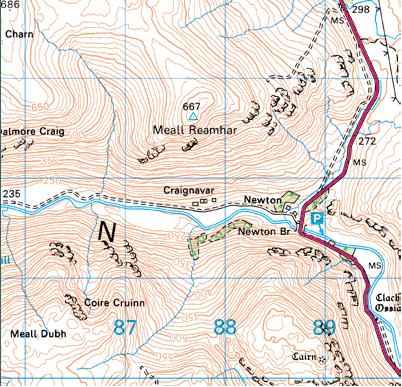
The Craig Navar township is an excellent site to visit and one that I visited today. Access to the site is very easy with parking available on the A822 at Newton Bridge, which in itself is a pleasant place to picnic.Crossing the road and walking for a round half a mile on an easy flat path, that takes you all the way to Loch Tay, you come across the remains of the township.


Position of Township
The Township, as detailed in 1863


The township is situated at NN 877 317.

The Ordance Survey Map from 1863 can be viewed here showing a detailed outline of the township, at this time recorded as in ruins

The site is on the right of the path on a hill and is cosnstructed of the remains of around 11 dwellings, each in varous states of decay, with the majority of walls no higher that 1.5mtrs, although there were some 2 or 3 fine examples of gables standing at a little over 2 mtrs. The remains of each designated 'plot' can still be traced, which gives a good outline of both the village and the size of each site.


Although the majority of the clearances are associated with the Highlands, there were extensive clearing exercises taking place in the lower highland areas, such as Perthshire. The 2nd Marquess of Breadalbane carried out an act of clearing parts of his huge estates and replacing people with sheep. The areas making up Glenquaich, which runs north-west from Amulree towards Loch Tay. From the furthest point the River Quaich runs South East from the hills into Loch Freuchie. Along the shore line of Loch Freuchie there are a further several sites of former townships and communities.

 I have added some pictures as a guide to the township. (copyright:Author)


East Approach to Township
Looking West across township


Looking West across Township


A Gable example
Corner stones on south facing gable
The remains of a dwelling


Lower dwelling remains
Middle positioned dwelling