The Highland Clearances. 'Fuadach nan Gàidheal'
Escorted Tours
Failte gu Fuadach nan Gaidhealt na h-Alba
Failte gu Fuadach nan Gaidhealt na h-Alba.
The Highland Clearances were a devestating part of the history of Scotland. For many it changed not only their way of life but also shaped the rural future of Scotland. Many villagers suffered at the hands of their landlords and tackmen and fought a desperate struggle to find a new life. Others managed to propser in a new life that never saw them return to Scotland again. Here is a resource that supports the documentation and historical value of this important area of Scottish history. You can follow in the footsteps of these villagers and find detailed descriptions and locations of the remains of some of the villages and townships through site descriptions, photographs and suggestions for further reading and links to follow.
Follow @theclearances Tweet
Wednesday, 16 January 2013
The Assynt Hidden Lives Project
The Assynt Hidden Lives Project was a programme of archaeological research, funded by public money through the Leader and the Heritage Lottery funds. The project was a survey and assessment project of the archaeological sites and monuments of the Assynt parish in Sutherland, including some of the cleared villages of the area.
The AOC Archaeology Group joined with Historic Assynt to manage and deliver a community-driven programme which aimed to characterise and record the archaeology of this under-studied area through a programme of walkover and archaeological site surveys.
The project and field survey is now complete and the work has been compiled into a fantastic report that is available, freely from their website, and also here as part of this post.
The full report can be accessed HERE
The website for the project can be accessed HERE
AOC Archaeology Group can be accessed HERE
Historical Assynt can be accessed HERE
Tuesday, 15 January 2013
Clachtoll Mill
This post picks up the baton from the last visit to the area as we wind our way back from Clachtoll towards Lochinver.
The path is, as you would expect, rocky, but it is clearly marked and the old mill comes into view very soon after leaving the road. The mill has been preserved by the Assynt Historical Society who do have an excellent website detailing the construction and workings of the Mill and this can be accessed by clicking on the link at the end of this post.
C. Ordnance Survey |
Leaving the site discussed in the last post we continue for approximately half a mile until we approach, on the right hand side of the road, a footpath leading down the side of the burn, directly towards the old mill located at Altan Na Bradhan. The footpath is on the right hand side of the road as you are travelling to Lochinver and follows the path of the burn feeding the mill.
The path is, as you would expect, rocky, but it is clearly marked and the old mill comes into view very soon after leaving the road. The mill has been preserved by the Assynt Historical Society who do have an excellent website detailing the construction and workings of the Mill and this can be accessed by clicking on the link at the end of this post.
Mill stone and Mill Wall. c: Author |
Information board at the site provided by Assynt Historical Society. c: Author. |
Once you have visited the mill, you have the choice of either continuing on past the mill, down towards the lovely beach, where you can spend a lovely time watching the blue waters for signs of whales, or turning around and retracing your steps, back across the burn, and immediately picking up the path that goes on over the coast towards the Beach and township area of Achmelvich. This is a path worth taking, if you have the time as you will reach the beautiful bay of Achmelvich, where whales and Dolphins can often be seen.
As you start up the path you will walk through the Cathair Dhubh estate and holiday chalets, where there is evidence of a small settlement.
c: Author |
c:Author |
c:Author |
These are wonderful remains and the structures have been protected from the unforgiving winds by the dunes and rocky escarpments surrounding them.
I will leave you here to carry on your walk to Achmelvich and the caravan park that forms the majority of the residency. Stop on the way at the croft at the peak of the walk and buy some lovely fresh produce and eggs for breakfast tomorrow. Make your way back along the road to the main road that we left and I will meet you later as we continue our walk to lochinver.
Assynt Historical Society. http://www.normist.co.uk/mills.htm
Wednesday, 9 January 2013
Clachtoll to Lochinver
Happy New Year!
In my last proper post of the last year I started a thread that concentrated on the area of Clachtoll. This beautiful area, as discussed, was an area created and grown from the silent clearances. These areas borne new industries for crofters that centred around the Kelp growing and distribution, that in itself was quite a successful enterprise for both laird and worker alike.
As you take the last look at the Salmon Bothy that we discussed in the last post, head onto the main road and follow the B869 to Lochinver. Take your time along this road as you will often be awarded with both spectacular views and glimpses of wildlife, birds of prey and deer. As you travel along this road, there are sites and remains of townships and crofts that are worth a look and will not be too far from the road.
The photographs here in this post focus on a small collection of buildings along the side of the road. A word here about the road. As beautiful as the road is, it is windy, single tracked and often blind on bends so be careful where you park and don not cause an obstruction.
This croft here is worth a look and you will be awarded with superb gable end structures (I am obsessed with Gable ends!)
As you can see from the photographs here, the scenery is stunning and these photographs were taken on a dreary day in October. These buildings, like many that you will come across have been used in recent times to house animals and often there are artifacts associated with modern crofting and agriculture.
Standing at this site and looking across the views in front of me, in the rain and winds, did give me a brief feeling of what it must have been like.
I was lucky enough to be staying about a mile from this site and in the evenings the whole area took on a whole new viewpoint as the clear night skies presented the most wonderful star lit sky I have ever seen.
Leaving this site, continue along the road for approximately half a mile and wait for me there. We will pick up the thread of this area in our next post
In my last proper post of the last year I started a thread that concentrated on the area of Clachtoll. This beautiful area, as discussed, was an area created and grown from the silent clearances. These areas borne new industries for crofters that centred around the Kelp growing and distribution, that in itself was quite a successful enterprise for both laird and worker alike.
C: Author |
The photographs here in this post focus on a small collection of buildings along the side of the road. A word here about the road. As beautiful as the road is, it is windy, single tracked and often blind on bends so be careful where you park and don not cause an obstruction.
c: Author |
c: Author |
This croft here is worth a look and you will be awarded with superb gable end structures (I am obsessed with Gable ends!)
c: Author |
c: Author |
Standing at this site and looking across the views in front of me, in the rain and winds, did give me a brief feeling of what it must have been like.
I was lucky enough to be staying about a mile from this site and in the evenings the whole area took on a whole new viewpoint as the clear night skies presented the most wonderful star lit sky I have ever seen.
Leaving this site, continue along the road for approximately half a mile and wait for me there. We will pick up the thread of this area in our next post
Monday, 17 December 2012
Merry Christmas and a Happy New Year
This is probably going to be the last chance that I wilI get to post to the blog, this side of the festive season. So, can I take this opportunity to wish all visitors, kindle subscribers and friends alike, a very merry Christmas. Hope you all have a lovely time and look forward to seeing you all here on the blog in 2013. If you are visiting Scotland, let me know and I will do my best to catch up with you.
The Clearances of Assynt. Clachtoll
We start our visit to this interesting area right out on the western peninsula, in the Assynt area at a place called Clachtoll. This is a beautiful place that allows oneself to be immersed in the history of the clearances. The districts of Assynt were to be a model of clearance for the Staffords as they geared up their agrarian revolution and focussed their energies upon the North Western straths of the area, upon the recommendations and direction of William Young. He proposed in a report written in 1812, that the large tracts of the parish be converted to Cheviot sheep walks.
By 1812, Assynt had been converted by the factors, Sellar and Young, without mishap or protest an event often attributed to inevitability brought about by a poor harvest that year. Most of the new sheep farmers were not from the South but Tacksmen who controlled influence over the inhabitants of the area. (1)
The Clachtoll road. C: Author |
As rosy as this account is, it is far from it and throughout this series on Assynt, I will discover more of the area and the stories surrounding this rugged and yet beautiful coastline that became both cleared from and cleared to. One such area is that of Clachtoll.
Clachtoll is a beautiful part of the area. Accessed by one road in, the scenery is both dramatic and barren. We were lucky enough to stay in Clachtoll for a week at a beautiful cottage, miles from anywhere and with only the rutting stags and starry skies for company.
Clachtoll is one such area that would have seen crofters cleared to, to take up new professions as kelpmakers, fishermen, lime burners and other new trades. The area is a collection of houses and dwellings that today provides both regular and holiday cottages.
Clachtoll Salmon Station. C: Author |
One feature that is worth a visit, is the Salmon bothy close to the beachy head. The Bothy dates back to 1846 and was built by Hector MacKenzie. This slamon station was one of many dotted along the coast which netted migrating salmon returning to the rivers Inver and Kirkaig. They were caught in nets which were set out along the coast by the fishermen. The nets were attached to these long posts, as can be seen in the photographs here. In it's heyday more than 100 salmon per day were netted, the season was from February 5th - August 20th
Salmon net poles. C: Author |
The Bothy was closed down in 1994, the last of the Salmon stations in the area.
(1) The Highland Clearances (2008) Richards, E. pg 167-8.
Tuesday, 4 December 2012
Glen Quaich: Amulree and Strathbaan Church
Amulree Church. Copyright: Author |
At the end of the Glen Quaich walk is a church that is the final stop on the journey in this area. The church at Amulree is always worthy of a visit as, not only is it an interesting little church but also as there is quite a lot of of information contained in the church relating to the clearances and the families that were removed from this area and their flight to new lands in Canada.
Copyright: Crown 2012 |
The hotel is now closed but does provide ample parking along the old military road. The church was built to a simple design by the architect John Douglas of Edinburgh between 1743 and 1752 (one of a possible three at work in Edinburgh at that time), a near contemporary of William Adam and it is possible that the same person was responsible for the design of Killin church, the 'Palladianisation' of Blair Castle, alterations at Taymouth Castle and the repairs to the palace of Holyrood. Remodelling work was carried out in 1881-2.
Map from 1855/ Copyright NLS / Crown |
The bell was cast in 1519, repaired in 1982, and was probably the work of Willem van den Ghein I. An inscription in old Flemish reads 'I was cast in the year of our Lord 1519'.
There were repairs carried out in 1989-90, and close inspection revealed that the vestry and porch were later additions as well as the more decorative style, size and placement of fenestration.
Internally simple, lit by six windows, the interior of the knave was shortened after 1958, to provide space for a Sunday school and meeting place and the inside gallery was boarded up to assist with economies in heating, it reduced the congregation area to around 120.
My thanks to Nick Weall who has kindly allowed me to reproduce this stunning picture of the church here on the blog.
Amurlee Church. Copyright: Nick Weall |
The role of the church was closely linked to the development and management of the straths and communities found within them and also closely linked with the Landlords at the time of the clearances. An excellent book to read that examines this relationship between the church,the state and the clearances is that written by David Paton 'The Clergy and the Clearances'. It is now out of print but can still be obtained from various resellers such as Amazon and ebay. A very worthy addition to anyone's library when reading and researching this subject.
Monday, 26 November 2012
Translocation 2013
Copyright: Timespan |
Timespan Museum and the Helmsdale community warmly invite you to Scotland’s northeast coast to participate in the Kildonan Clearances Bicentenary from Friday 2nd – Sunday 18th August 2013.
Timespan’s Translocation project commencing in January 2013 will follow the historical calendar of events beginning with the ‘Kildonan Riots’ in January 1813, when an uprising by the farming tenant’s showed the landowners and the outside world that the majority of the population of the Strath of Kildonan were not willing participants in the agricultural changes that were forced upon them at the time of the Highland Clearances. This led to a mass exodus of people from the Strath of Kildonan to Lord Selkirk’s newly created settlement along the Red River (now Winnipeg) in North America.
The typhus ridden ship carrying the Kildonan people arrived at Churchill on the coast of Hudson Bay on 12th August 1813, where some of the unfortunate party who succumbed to illness were buried. It took nearly another year for the remainder of the intrepid group to reach Red River, which they did in August 1814.
For more information, visit the Timespan Museum information page HERE
The strath of Glencalvie: Croick Church.
Well here we are nearly at the end of another year and my apologises for being away for a couple of months or so. I have not been idling the time away as I have been out and about over the summer, collecting new material for the blog and taking small parties out to visit some of the areas.
Croick church |
One of the sites that I have been lucky enough to visit is probably one of the most iconic and well known sites associated with the struggles of the highlanders throughout the clearances and that is Croick Church.
On the day of our visit in October, the weather was closing in and the cold swirling mist and rain added to the atmosphere as we drove from Bonar Bridge to the village of Ardgay. From here turn right (or left, depending upon your direction of travel!) and follow onto Church Street. From here you start a journey of around 10 miles to the site of the church, following the river and the many twists and turns as you travel deeper into the strath and the history of time.
The entrance to the church |
When you finally reach the site of the church you are deep in the recess of the glen and you can't help but feel immersed in the history and troubles of the area as you walk upto the gate of the church.
The church is open throughout the day to visitors, and once you have descended the steps and entered the church, it is worth just stopping for a moment to reflect over the ground upon which you are walking and the families, young and old who would have made the same entrance to the church as you just have, all those years ago as part of one of the most famous and most notable of the clearances, the Glencalvie clearances in 1845.
These particular clearances and events took place in 1845 and were centred around 18 families who were petitioned to be removed on the 12 of May that year. These families, from the Straths of Glencalvie, Amatnatua and Greenyards, also took their plight to the newspapers through their ministers and also approached the factor James Falconer Gillanders who was acting upon the instruction of the absent landlord, Major Charles Robertson of Kindeace.
The plight of those affected by the Clencalvie clearances their struggles and attempts was made all the more prolific and brought to the attention of those outside of Scotland through the attendance of a reporter from The Times Newspaper of London who was able to witness the sight and report it in the newspaper for his readership in 1845 and also through petitioned discussion and text placed in The Scotsman by ministers of the Free Church on behalf of the families involved.
Plaque at the entrance to the church. |
Due to the attention that these various avenues attracted their was a slight stay granted until the 25th of May so that alternative accommodation could be sought. it is reported that only 6 families did arrange some form of refuge in Bonar Bridge and Edderton with the rest unable to secure anything and it is these families that left their homes at the end of May and sought refuge in the church yard.
It is here that many etched their presence in the windows of the church, and although they sought refuge outside in the yard, the etchings are found within the church itself, suggesting that attendance at some sort of support and worship was still taking place.
The East window. |
Transcript of the etchings |
It is not known what became of the families, although their plight served to create much debate around the great injustices taking place in the highlands.
This is a very brief outline of what took place and I will be updating this story and adding other features around this event as I update the blog through the coming winter months.
Further information can be obtained from the official website of the church, along with some photo's showing the inside in greater detail
http://www.croickchurch.com/clearances.htm this can also be accessed HERE
Monday, 9 July 2012
Book Watch: The Man Who Went To Farr.
'The Man Who Went to Farr'
J.G. Leith
Published: 2010
It is nearly 200 years since Patrick Sellar stood accused of culpable homicide for his part in the Sutherland Clearances. Yet his name continues to reverberate around the Highlands. This book pulls together some of the substantial and the circumstantial evidence
Copyright: Baseline Publ. |
Patrick Sellar was acquitted, and no one can argue, that in law, he was cleared of all charges brought against him, but he was never able to escape the continuing clamour and ever present accusations. At various points throughout his life he felt the need to reiterate his proven innocence and even after his death, his family were moved to continue offering explanations in his defence.
Today, the debate rumbles on amidst the ongoing indulgence in discussion about the Highland Clearances. There exists a wealth of published material on the ‘clearances’, some of which has placed Sellar and his trial in a central position.
This is the not trial of Patrick Sellar by hindsight but instead a presentation of not just what was examined by the then High Court in Inverness on 26th April 1816, but also what was being said and often inferred by some who never received the opportunity to give evidence and some who were effectively precluded from giving evidence. And yet there were others who knew many of the real truths, but either from fear or for favour remained silent.
Our witnesses all had some knowledge of the events in Strathnaver, some of it maybe not at first hand but they would have been familiar with and close enough in time and place to know where many of the truths lay. In fact this is more an examination of those involved in the Strathnaver Clearances. Patrick Sellar, was acquitted by due legal process, but in truth he was not the only person who might be considered either tainted by the episode or even culpable of creating the means, failing to act or benefiting from the outcomes.
The aim of this work is to try and create a bigger picture – a picture that still remains incomplete, but may stimulate others who hold missing links and pieces to engage in the debate.
The book is available from Amazon, amongst others.
Tuesday, 3 July 2012
Timespan Tour.
Timespan is celebrating the 'Festival of British Archaeology' with a tour of Learable Hill in the Strath of Kildonan on Saturday 21st July 10am-3pm. If you are in the area and can make it, this promises to be a super day out.
They will be looking at over 6000 years of settlement in the area from prehistoric stone rows to clearance townships. Moderate to difficult walking and not suitable for children under eight.
Book your place on the minibus now or call Timespan for more information. Timespan can be reached at:
Timespan
Dunrobin Street,
Helmsdale,
Sutherland,
KW8 6JX
Helmsdale,
Sutherland,
KW8 6JX
Tel: 01431 821327
Email: enquiries@timespan.org.uk
@Timespan #Timespan
Monday, 2 July 2012
Key figures in the Clearances~ James Loch
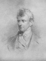
James Loch. 1780 -1855 |
I want to try and bring some of the key figures associated with the Clearances to the front here on the blog and I will start this series with James Loch.
James Loch (7 May,1780–28 June,1855) was a Scottish economist, advocate, barrister, estate commissioner and later a member of parliament.
Loch was born near Edinburgh and when his father died, in 1788, he went to live with his uncle, the prominent lawyer and politician William Adam KC (1751–1839) on the Blair Adam estate near to Kelty in Kinross-shire.
The estate was developed by his Grandfather, also called William Adam, who, from around 1731 after purchasing the estate known as Blair Crambeth, renamed the estate Blair Adam, and set about expanding and improving it, planting trees, enclosing land, and setting up coal mines. He also established the local village of Maryburgh, naming it after his wife, to provide housing for the miners. Upon his death the estate passed to his son and later to his son, William.
Hence the legacy of estate management, design and structure would have been prominent within the day to day life of the young James and although James returned to Edinburgh to study law and go on to develop an interest in politics, he opted instead to persue a career in estate management.
Leaving his connection with Sutherland to one side for a moment, in his role as Chief Agent to the first and second Dukes of Sutherland, James Loch was instrumental in the development of both canal and railway networks in Britain. Appointed director of the Grand Junction Railway and also of the Liverpool and Manchester Railway, Loch held a number of public offices and was one of the founding figures of London University. He also combined this work, and his work on the Sutherland estates, with parliamentary duties as an MP between 1827 and 1852, representing the burghs of Wick, Tain and St. Germans in Cornwall.
But it is for the work in Sutherland that he, for much of his life, carried out to effect across the land. Not really the architect, more the engineer of design and apologist for the Duchess, who implemented the changes, often aggressively and notoriously 'so as to mould and control the lives of the ignorant and credulous people' that at one time, the young among the families throughout the estate of in Sunderland, had to go to Loch's agents for permission to marry' (Preeble, J.) According to Loch's own writings, "In a few years the character of the whole of this population will be completely changed... The children of those who are removed from the hills will lose all recollection of the habits and customs of their fathers".
As famed for his work on the estate for his masters the Duke and Duchess of Sutherland, it is also his writings, in the form of the publication in 1820 of the work entitled 'An account of the improvements on the estates of the Marquess of Stafford, in the counties of Stafford and Salop, and on the estate of Sutherland'. A book that came to try and justify the changes and developments being made at the time and one that became a handbook for other 'improvers' both in the UK and almost in the new and emerging continent in the USA.
A copy of the book can still be obtained from various sellers and is also available free, to download, on google play books.
Copyright Edwardx |
The thanks from the Duchess and the now second Duke, to the man who effected their plans, was so great that a monument was erected to Loch, on the estate in 1858 with the following inscription.
Copyright: Peter Moore |
James Loch
who loved in the serene
evening of his life
to look around him here.
May his children's children gather here
and think of him
whose life was spent in virtuous labour
for the land he loved
for the friends he served
Copyright: Ordnance Survey |
The photograph of the monument was taken in 2010 and is hidden from view by overgrown and mature woodland.
The location is within Dunrobin wood on the outside of Golspie at NC874017. The position is indicated on the map in yellow. The site is well worth a visit and there are plenty of other sites to visit as this is right in the heart of the clearance movement.
So often, the changes within Scotland took place at a discreet distance from London and those often supporting the changes, that often they were carried out in isolation. But times were changing, and national records were beginning to be developed. An overview and statistical record of agriculture and practises on the land were being carried out across all counties of Great Britain and one was concluded in 1822 for the county of Sutherland, charting land ownership, use and developments. htttp://www.countysutherland.co.uk/102.html
A range of letters, documents and information regarding Loch and the Sutherland estate can be viewed by visiting the Sutherland Collection, held in trust by Staffordshire and Stoke on Trent Council. This can be accessed here
Saturday, 30 June 2012
Eric Richards to take up visiting role in the Highlands
Prof. Eric Richards, the internationally renowned expert on the Highland Clearances, will be moving to Dornoch to work with the University of the Highlands and Islands. He has accepted a visiting Professorship with the University's Centre for History. His four-month visit to the east Sutherland town is being funded by a grant from the Carnegie Trust.
Due to start in 2014, Professor Richard's time with the University will come shortly after the 200th anniversary of the Strath of Kildonan and Strathnaver Clearances which took place near Helmsdale from 1813. His visit should benefit both his own research and the local community as he hopes to use local archives, teach and supervise students and give talks to history societies and the public.
Speaking about the visit, Professor Richards said: "A Centre for the study of History in a brand new University in the Highlands and Islands is a dream realised. The bicentenary of the northern Clearances coincides with the present regeneration of the region. I can't think of a better time to be visiting UHI at Dornoch, to recharge my own work on the Highlands and to be part of the exciting agenda of the Centre for History. And, as a migrant myself, and a historian of international migration, this will be an ideal historical laboratory. Being in such close proximity to Andrew Carnegie's old home gives the Centenary Professorship an added frisson."
More information can be found Here
Thursday, 28 June 2012
The Highland Drovers
The BBC have recently been airing a TV series called
'Britain's Lost Routes, following, as the name suggests, routes across the UK
that have been lost to the mists of time. In this episode, Griff Rhys Jones throws
himself back into the early 19th century, joining a herd of highland cows and
two sturdy farmers as they retrace an ancient droving route once taken by
thousands as they trudged 250 miles through the Scottish highlands from the
Isle of Skye down to Falkirk market.
Braving the ravages of the Scottish weather, Griff and his companions
relive the arduous and dangerous trek through steep mountain passes and fast
flowing rivers that drovers and their herds made so that the great British
public could get beef on its dinner plate. As they go they discover how drovers
once risked life and limb to swim their cattle from the Scottish islands to the
mainland, braving the inclement conditions in their wet plaid and fending off
rustlers with sharp shooting. Griff explores how these hardy men went on to become the
first cowboys of the wild west as well as becoming the stuff of literary
legend.
The series does make a light reference to the Highland Clearances, but provides an insight into the particular part of Highland Life at the time that change would be taking place across the Highlands.
Clicking here will take you to the web page for the episode and the series.
Subscribe to:
Posts (Atom)